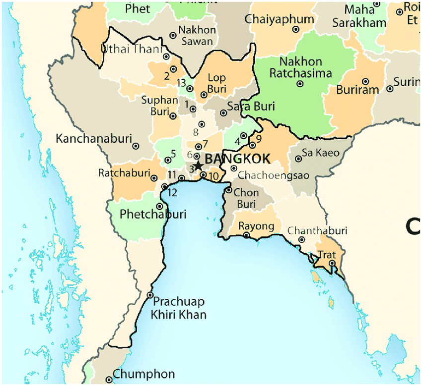
Map of Central Thailand
Central Thailand reveals a contrasting face, between agricultural wealth, sought-after landscapes, historical remnants and Bangkok, the great capital crossed by the Chao Phraya.
Surrounded by the mountain range of Burma and the Isan plateau, the central region stretches from the northern part of the country to Nakhon Sawan. The provinces of Prachuap Khiri Khan, Trat, Sa Kaeo, Lopburi and Kanchanaburi trace its borders. In this region, the Ping, Wang, Nan and Yom rivers converge to form the Chao Phraya river, which flows through the city of Bangkok, the country's capital. This latter flows through the heart of the central plain as well as the capital, making the surrounding lands fertile. It thus enables Thailand to be a country with developed agriculture ranging from rice cultivation to grape growing, passing through banana fields. Markets and supermarkets throughout the country are thus filled with local products year-round.
These days, the tourism sector sometimes overshadows agricultural production. With its fine sandy beaches and karst landscapes, certain parts of the region have become a favorite destination for foreign tourists. Moreover, the region is home to interesting historical sites. These include Nakhon Pathom, Kanchanaburi, Bang Pa-In, Ayutthaya and Lopburi. It also hosts Bangkok, the national capital. This immense metropolis is the birthplace of numerous royal temples, vast shopping centers and more than 100 historical and cultural museums. Nicknamed by Europeans "the Venice of the Orient," it also allows for cruises on the Chao Phraya and its many canals, which offer a sensational experience to foreign tourists.
Frequently asked questions
Central Thailand is home to major sites such as Bangkok with its royal temples, Ayutthaya the former capital, Kanchanaburi and its historic bridges, as well as Lopburi known for its temples and monkeys.
The central region is well served by transportation. From Bangkok, you can use trains, buses or organized excursions to visit Ayutthaya, Kanchanaburi and other historical sites.
The ideal period extends from November to February with milder temperatures and less rainfall, perfect for exploring Bangkok and the surrounding historical sites.