
Exceptional hiking in the heart of Adrar Mauritania
In the footsteps of the Amgârîj nomads, in the millennial secrets of the eastern Adrâr
Duration
23 days
Ideal seasons
Jan, Feb, Mar, Oct, Nov, Dec
Style
Expeditions
Comfort
rustique
Travelers
Solo, With friends, groupe
The spirit of travel
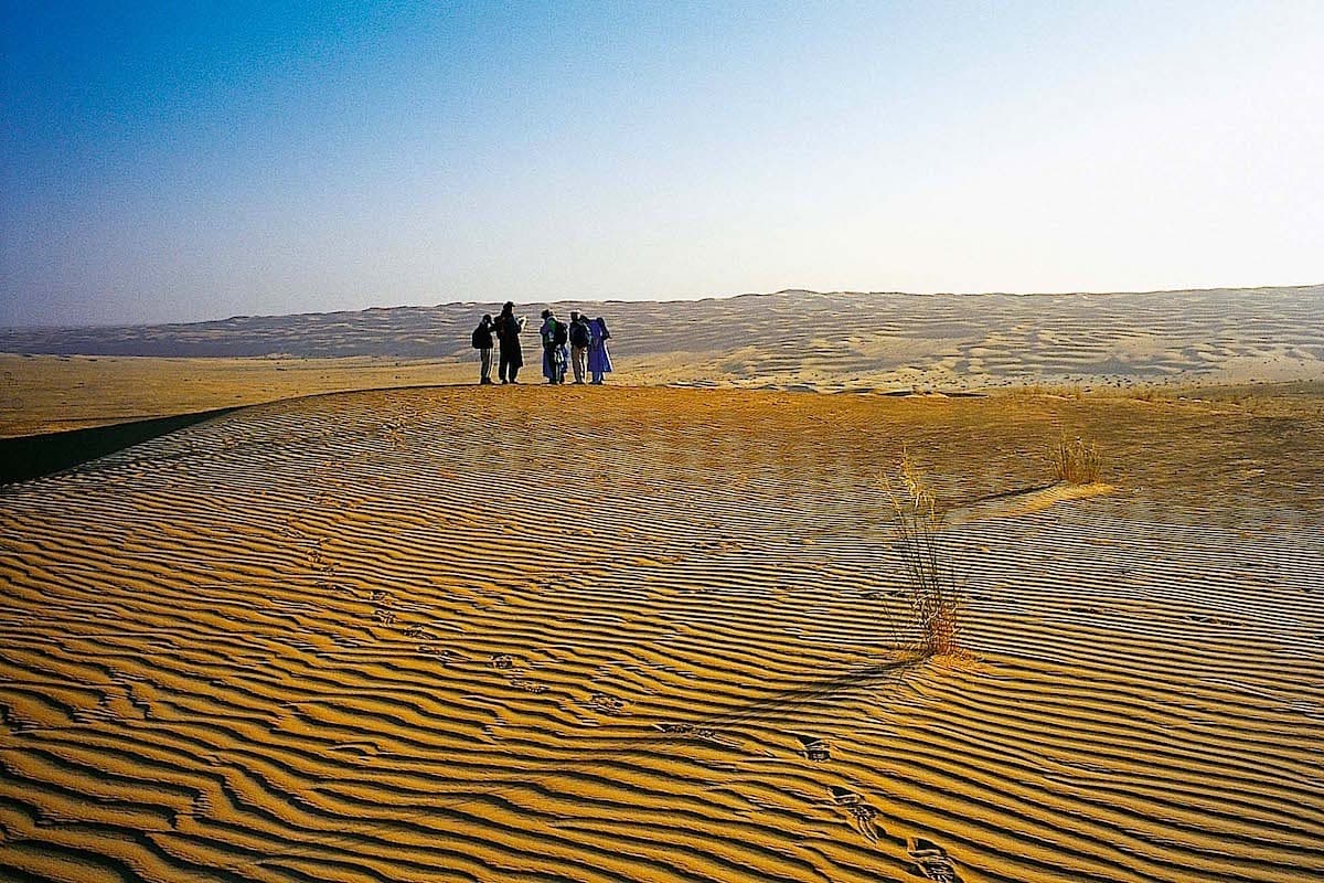
This great journey takes place in a little-known part of the Adrâr mauritanien.
While the Guelb Er Rîchât and sometimes El Beyyed are visited by tourist groups or scientific missions, three quarters of the itinerary we propose to you unfold in intimate places in eastern Mauritanie.
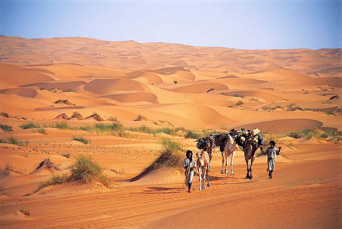
This route is only possible thanks to years of exploration and travel in the company of Amgârîj nomads.
Patiently, mutual trust and friendship have been established and allow us to discover together unsuspected places, hidden water sources, which have always been jealously guarded secrets. It is true that the stakes are no longer the same, no more raids, no more pressure for territorial or tribal domination.
The vast Mauritanian spaces gradually reveal themselves to those who have patience… Starting from Wadâne, isolation is complete. Water sources depend on the frequency of the zone being visited by nomads. We can travel 5 to 6 days without a well.
This camel trek requires excellent physical and psychological fitness.
It is an itinerary with distant horizons, turbulent landscapes and imposing reliefs. These are the key words of this journey. .
Of sustained level, this camel trek requires excellent physical and psychological fitness.
Sustained: 5 to 8 hours of hiking per day. Excellent physical condition necessary as stages can be long. You must be able to maintain this pace for several days in difficult terrain.
The stages of your journey
Highlights
Day-by-day itinerary
Flight departing from Paris to Nouakchott
Paris Aéroport → Nouakchott
Indicative flight suggestion: Royal Air Maroc.
We take off in the late afternoon for the Mauritanian capital via Casablanca in Morocco. Once formalities are completed, we welcome you in the hall of the Nouakchott airport terminal.
By a short transfer into town, we reach our hotel in the middle of the night for well-deserved rest.
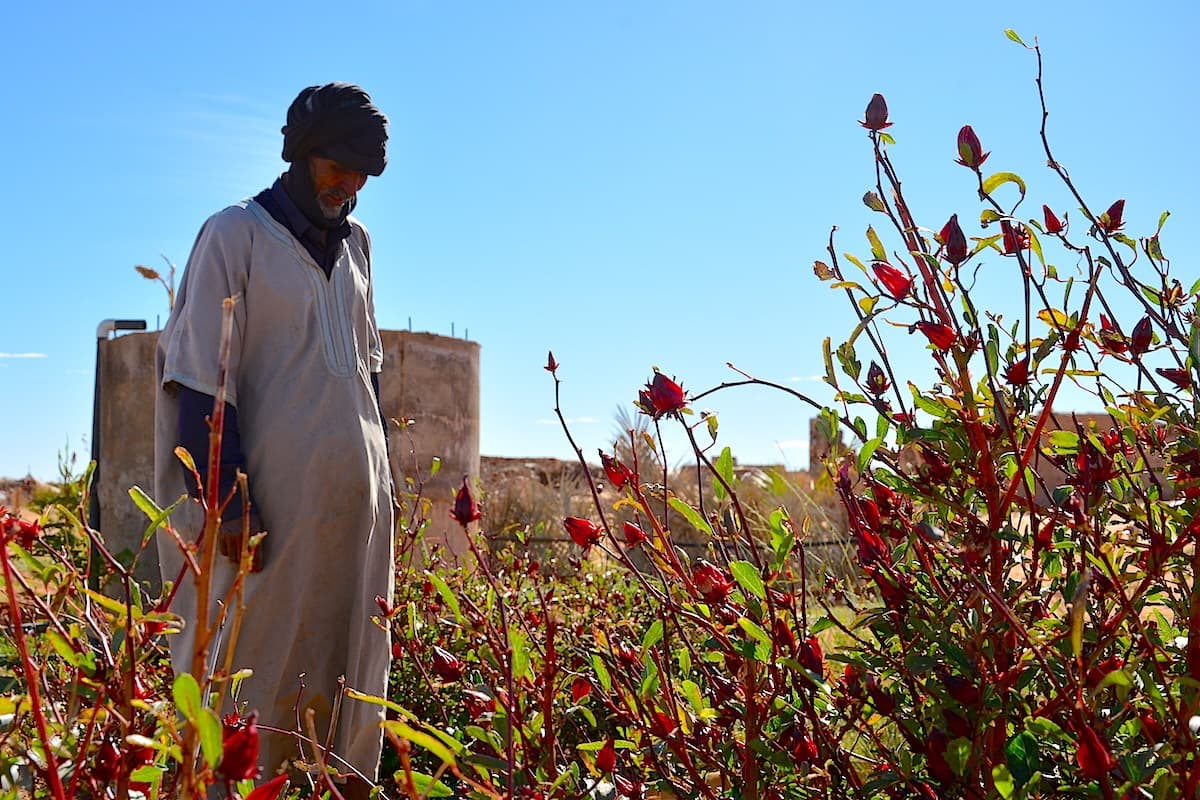
Heading towards El Kheouiya campsite
After leaving the city and its suburbs, we take the beautiful paved road that heads northeast towards the mining town of Akjoujt.
The Trarza region and the Atlantic coast are now behind us, the vegetation changes and becomes increasingly Saharan.
The large sandy plains of Inchiri lead us to the somewhat surreal town of Akjoujt. A mining industry is present there and, since the Chalcolithic, Man has extracted copper, gold and other materials.
Gradually the landscape changes. You are now driving in the Amsaga region.
In the distance, to the east, the dark barrier of Adrâr begins to take shape. You pass the great alluvial plain of Yagref and the village of Aïn Ahel Taya. The road crosses the first escarpment of Adrâr.
Atar → El Kheouiya
The track leading up to the plateau (dhar) is currently in good condition, though it can be damaged by rains that occur in late summer.
A small detour allows you to discover the magnificent landscapes of the Adrâr cliffs. The ruins of Fort Saganne, rock paintings, the succession of plateaus on the horizon are all attractions …
The final third unfolds along the northern edge of the sandy area.
Late in the morning, we reach El Kheouiya.
This is the meeting point with our Moorish travel companions with whom we share these few days. They belong to this small semi-nomadic camp.
The El Kheouiya semi-nomadic camp is established there during major droughts. Over the past few years, the camp has been developing: growth of goat and camelid herding (from 2 camels in 1993, there is now a herd of over 70 animals), creation of a school in 1994, development of a small date palm grove combined with gardens in 1999 and, now, some permanent structures.
"But we still live in tents," Atfeil, the camp leader, assures us…
The relationships we maintain with the different families of the camp are close and genuinely friendly.
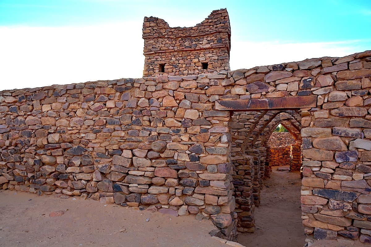
Heading towards the ksar of Wadâne and the vast Saharan spaces
El Kheouiya → Wadane
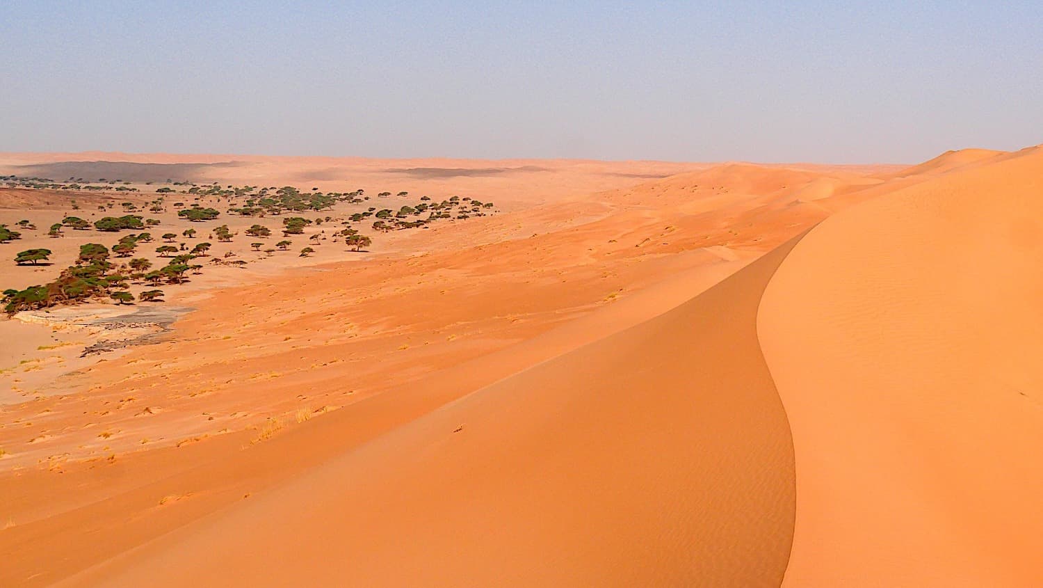
We now follow the erg Warane which runs along the Adrâr plateau from the eastern borders. It marks the difficult-to-cross boundary by car of the immense empty space, the Majabat Al Koubra.
The Tanouchert palm grove nestled in its setting of dunes has traversed the centuries while maintaining a certain luster.
To the west, the mega sandstone ridge of Herour winds through the heart of the dunes. Like the Zarga massif, Herour has a fascinating geomorphological history.
We reach the El Kheouiya semi-nomadic camp. Established on the banks of a major wadi, our hosts have marked our history.
Wadane → Oudeï Chouk
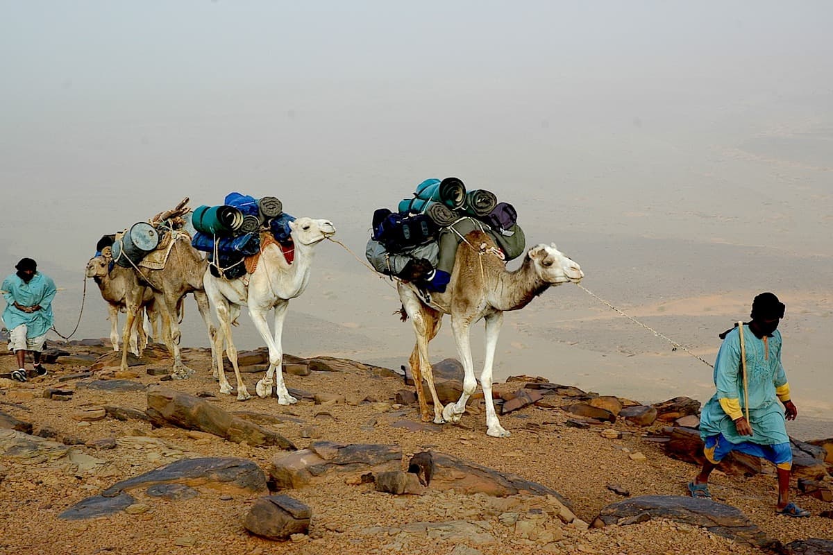
The camel team awaits us in the southeast of the city.
All originating from the surroundings of Wadâne, the camel drivers generally come from the tribes of northeastern Mauritania : essentially Amgârîj, Kounta or more rarely R'gueïbat.
Excellent travel companions for the past few years now, they are fast, efficient and discreet.
The bivouac is established near the camel drivers.
The vehicles return to Atar (180 km to the west) after being unloaded.
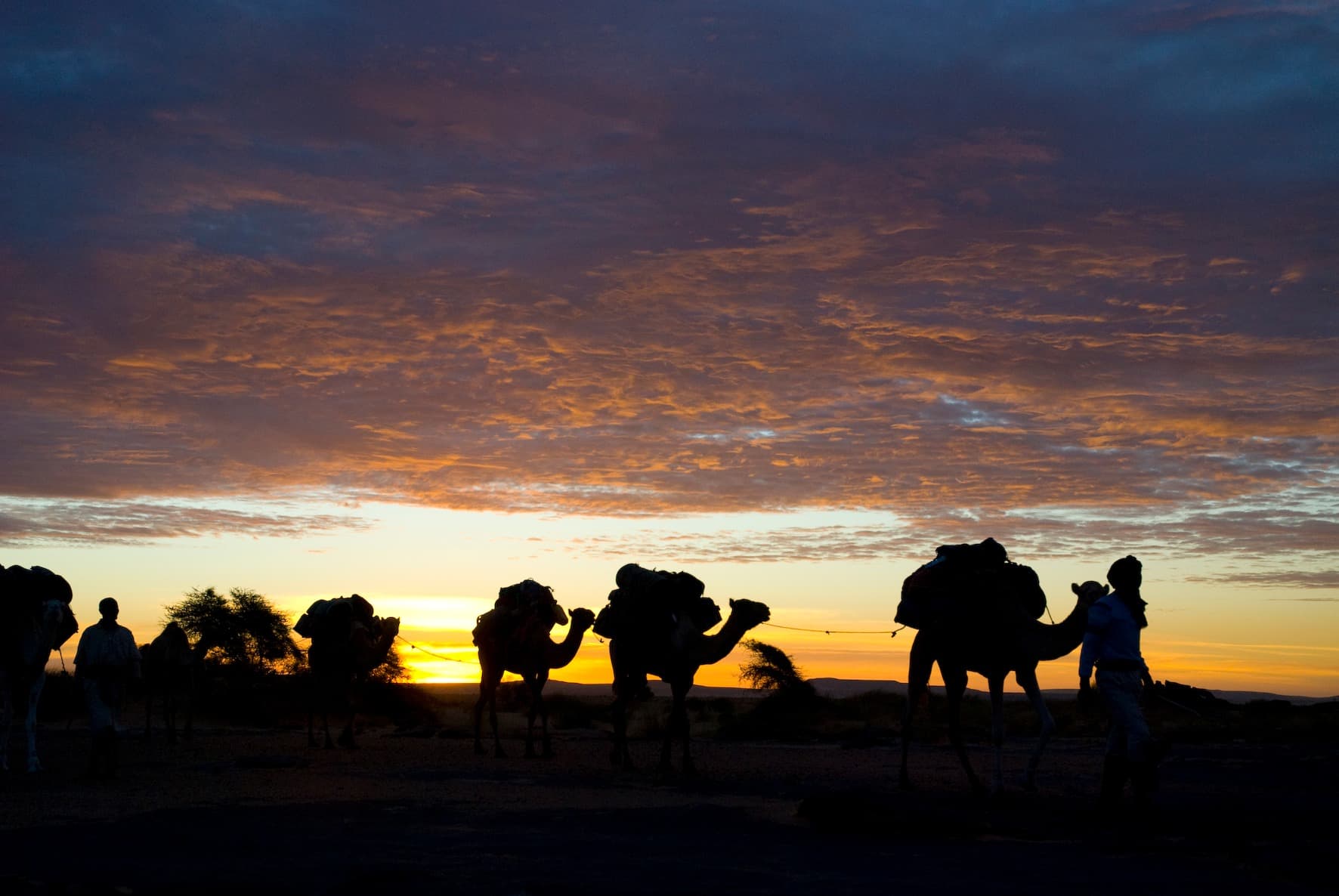
Daily schedule of camel trekking :
In Mauritanie, the rhythm is generally as follows :
Wake up at sunrise. At breakfast time, each participant brings their travel bag and mattress so that the camel herders can quickly distribute the loads and saddle the animals.
Departure between 7 a.m. and 8 a.m., and walking until 11 a.m. or 12 p.m. depending on the season and stages.
The midday break can be long due to the hot hours of the day. Camels are systematically unloaded and led to pasture.
After lunch : 2.5 to 3 hours of walking, depending on the stages.
Arrival at the end of the day at camp, which leaves the early evening free before dinner and evening gathering.
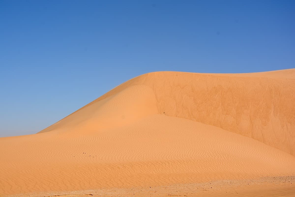
On camel trek, heading due South-East towards Meyateg
Oudeï Chouk → Meyateg
The camel trek begins. On foot, we walk along the batha Wadâne where the lushness of acacias, balanites and other leptadenias mixes with cereal crops and date palms. The region of Wadâne was the birthplace of date palm cultivation in Mauritania (date palm farming), which dates back approximately 1600 years. We find there very tasty varieties of dates such as sékany, tmar el hamra. We turn towards the southeast in the direction of the Meyatêg depression. The blonde sand of the Wârane encircles this immense basin which has always been a highly prized place by various human groups. The numerous pre-Islamic funerary remains (tumuli) here have refined forms. Overlooking the palm groves, we spend the night on the dunes surrounding Meyatêg.
The country is not empty, Mauritanie remains a great land of Nomads.
Throughout the journey, especially if grazing is good, we can spot nomadic tents, brown (made of wool and hair) or white (canvas), whose edges are raised as soon as it gets hot or there is no wind.
These nomads are generally welcoming but you can only visit them if you have a good reason to do so. We may have the opportunity to enter a tent to drink tea (three glasses!) and zrig, fresh or soured milk, mixed with sweet water.
This is not frequent because, if one knows local customs, one knows that it is not customary to enter a tent when you are not invited and especially when the nomads encountered are not part of the family of the guide and the camel drivers accompanying us.
Herds of camels, she-camels and baby camels are everywhere, as well as goats, sheep, cattle and donkeys. During the hot season, even if the grazing is very green, it is a captivating sight to see all these animals being watered as they patiently wait their turn at the wells or at the oglats (a group of wells).
The palm grove, the sand and the bâten
Meyateg → Hassi Thiba
After crossing traditional farming areas where millet, sorghum and sometimes wheat or barley grow, we reach, in the northeast of the area, the aklé which separates us from the Hôfrat Wadâne. This vast arc-shaped corridor is the southern periphery of the geomorphological complex of Guelb er Rîchât. The remains of the old Agwadir fort, which some attribute to the Portuguese, are still visible. It is most likely a more recent Moroccan construction dating from the time when the Alaouite sultans had designs on the opulent caravan city. We set up camp a few kilometers away, near Hassi Thibâ.
Discovering the Curiosity of Guelb Er Rîchat
Hassi Thiba → Guelb Er Richât
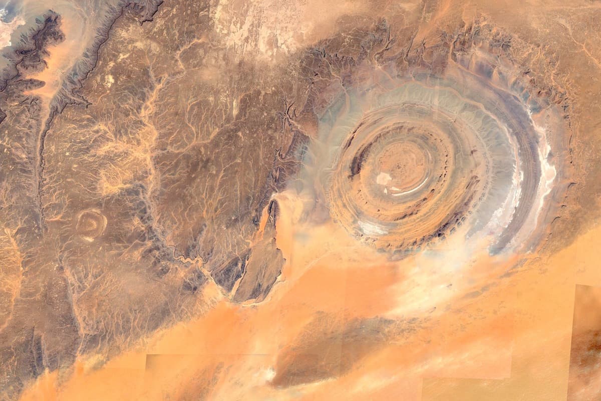
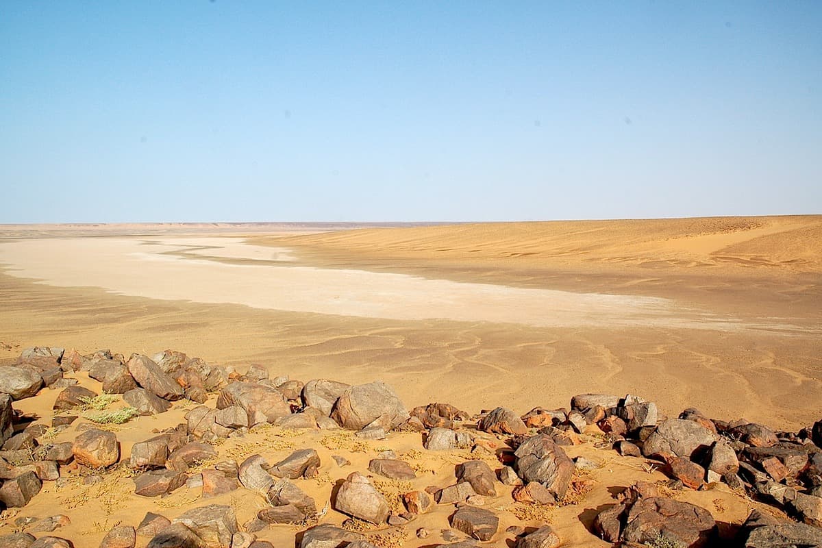
The first dome of the Richat is there. The relative richness of the wooded Hofrat gives way to mineral barrenness. The sands are replaced by black reg dotted by the raised ridges of the different concentric richs.
The eroded dome of Guelb Er Richât, which appears during the secondary period, is located at the edge of the dark mountains of the Mauritanian Adrâr to the west, and the vast expanses of rocks, rocky slabs and dunes of the Taoudenni basin to the east.
The strange system of concentric ridges of the Richât is so imposing that it appears today on all maps, even at small scales.
Richât is the plural of richa (feather), a term that perfectly describes the appearance of its ridges, whose leeward sides are streaked with tongues of sand and which dominate the deep plains where goats and camels graze… when, by chance, it has rained.
Because of its very size, it was revealed only much later, by professor Théodore Monod in 1934.
Indeed, no one, whether coming from the rugged plateaus of the north or the dunes of Majabat Al Koubra (Monod, 1958), to the south and south-east, could imagine that these low ridges would be organized into such a perfect concentric system, vaguely elliptical in shape of 22 km and 25 km in diameter, emerging from a window of 45 km, the Taguenzé, opened in the sandstone plateau.
The crossing of the Guelb and the mineral austerity of the Taguenze
Guelb Er Rîchat (Camp Boisé) → Tilililit
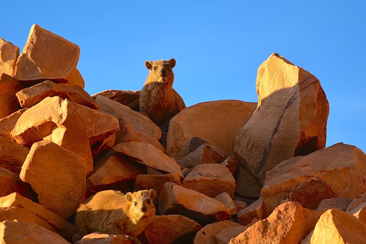
Heading northeast, we follow the many camel tracks that crisscross the massif. Here and there, a few brown tents huddle in the folds of the terrain. A few families raise herds of goats. Currently we sometimes see flocks of sheep that can only survive thanks to the beneficial rains of recent years. We approach a succession of well-marked ridges from the top of which we have, in clear weather, the best view of the concentric system of the Richât. Having reached the last richa, we have lunch beneath the sparse acacias of Megsem el Hârane. This "gate" consists of a ridge line with eroded rocks between which reddish sand mingles. After the meal, we embark on the long crossing of black reg that marks the head of the wadis Akerdil then Tilililt.
The bivouac is set up on the edge of a wadi in the midst of the most austere surroundings.
Rock Art in the Eastern Adrâr:
Since 1995, as part of our trekking expeditions, we have explored different regions of Mauritania, and in particular the Adrar.
In the article you can download, we wish to present engraved sites in the north-east region, some of which are probably previously unpublished. We restrict the north-eastern Adrar to the sandstone massif of dhar Chinguetti; the Adrar, geographically speaking, encompasses its northern margins the Assabet, the Jbeliat…
Although familiar with other engraved sites in the eastern Adrar (Lemqader, Ti-n-Labbe, …), we wish to focus our attention on 6 stations (2 of which can be linked to the El Beyyed cirque site) which seem to us representative of the rock art of the region, each containing a significant number of representations (Fig. 1). To our knowledge, only a few engravings have been published in scattered form, as drawings (Vernet, 1993; Mauny, 1954; Monod, 1938). We have been cataloguing these sites since 1995. The eastern Adrar is predominantly an engraved site terrain, whereas the reverse is true for the western Adrar.
The inversion follows an almost north-south line at the level of Chinguetti / Choum. The painted sites of the Adrar appear more dispersed, which makes inventory more difficult. Moving south, engravings are only found on the dhars Tichitt-Oualata, with Tagant currently only containing paintings according to current knowledge.
The plateau and testimonies of a distant past
Tilililit → Oued Oua'n Amoûr
The camel tracks converge towards Kneig Tilililt. The horizon is cut by the brown and steep cliffs of Taguenze. They mark the outer edge of Guelb er Rîchât.
The wide gorge leads us to the Tilililt spring. Day and night, mammals and birds gather by the hundreds around the only water point.
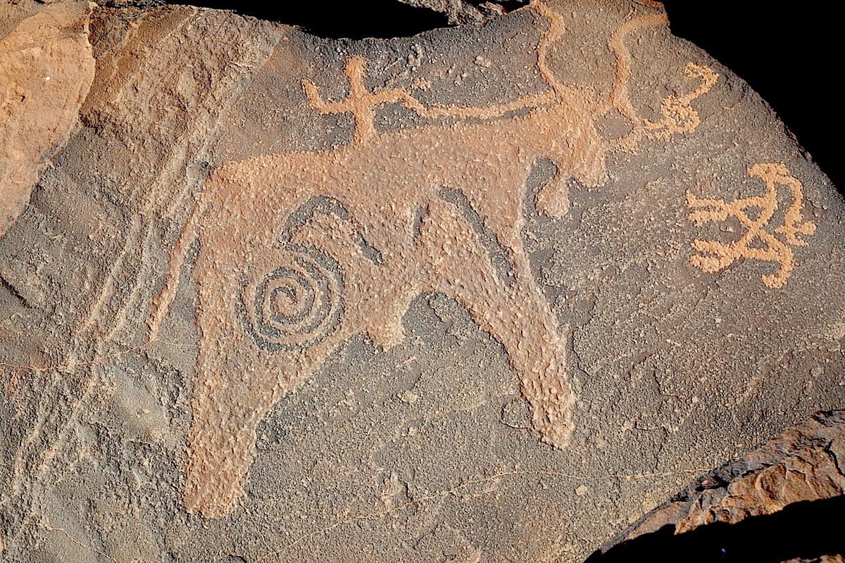
Nearby, on the black sandstone slabs, dozens of rock engravings demonstrate the antiquity and importance of this site. Two unexpectedly engraved elephants are found here.
By a steep donkey trail, we set foot on the plateau. The guelb remains behind us. Following a northwest route, we reach, after crossing a vast expanse of undulating reg, the Oua'n Amoûr wadi.
We establish our camp on a sandy tongue dotted with Acacia seyal and jujube trees. A few dorcas gazelles make their home in the area but remain very difficult to observe. The camels and our presence cause them to flee far into these open environments. To the west, the immense rectilinear Azilal plateau is their domain.
In Wadâne, in the past and until the 1975s, certain castes of the Amgârîj tribe were semi-professional hunters of Addax and gazelles just like the N'mâdi in the southeast of Mauritania. These hunting expeditions have a name: the gueïmarés. The memory of those times is still very vivid …
El Beyyed Circus, a major site of the Mauritanian Sahara
Oued Oua'n Amoûr → El Beyyed
Upstream from the Enchegdâne wadi, a very significant rock art site is observable.
Outside the survey areas, these testimonies of the past are known only to a few people. We can observe there, on horizontal slabs of black sandstone, around forty engravings presenting essentially bovids dating, apparently, to approximately 3000 years ago.
In the downstream section, various representations spread across the cliffs bordering the wadi: ostriches, antelopes, bovids and some significant areas of ancient Berber writing - tifinagh.
We follow the course of the Enchegdâne wadi which quickly descends into deep gorges. Downstream, the wadi widens and joins the amphitheatre of El Beyyed. We bivouac near the well of El Beyyed.
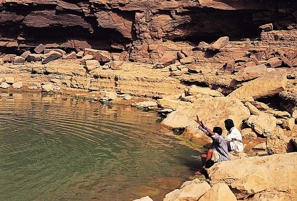
Gueltastes and rock engravings of El Beyyed then the sands of Maghteir
The El Beyyed corridor presents, over nearly 20km in the direction of El Ghallaouiyya, a considerable quantity of lithic material. The region offers some of the main sites of bifaces and worked pebbles in western Sahara. The multiple rock art sites represent here samples of so-called "Ethiopian" fauna such as giraffes, elephants, rhinoceroses... This fauna is believed to have disappeared from the area approximately 10,000 to 12,000 years ago. El Beyyed is located at the foot of the great dhar of the Adrâr and, to the north, develops an immense and powerful erg: the Maghteïr.
El Beyyed → Erg Maghteïr 1
After crossing the cirque, the caravan enters the edge of the erg Maghteïr. There, sand regains its rights and the sbot (Aristida pungens) suddenly replaces the M'rkba (Panicum turgidum). Some years, the southern aklé of the erg is generous and each movement of terrain can hide a campsite.
Camel herders often settle in spring in the large dune massifs to benefit from young pastures maintained by the sands.
We find the serenity of the dunes again for our bivouac.
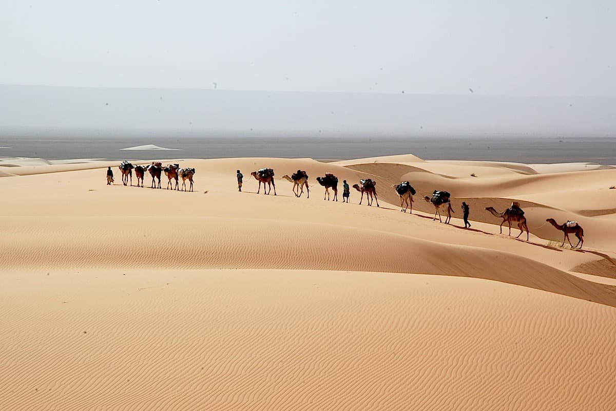
High sea navigation in the Maghteir erg
Erg Maghteïr 1 → Erg Maghteïr 2
We continue our progression into the erg. The aklé gradually loosens and reveals the great âlab that make up the architecture of the Maghteïr. The texture changes, the color evolves as well, we transition onto brown-red sands that testify to the age of the massif.
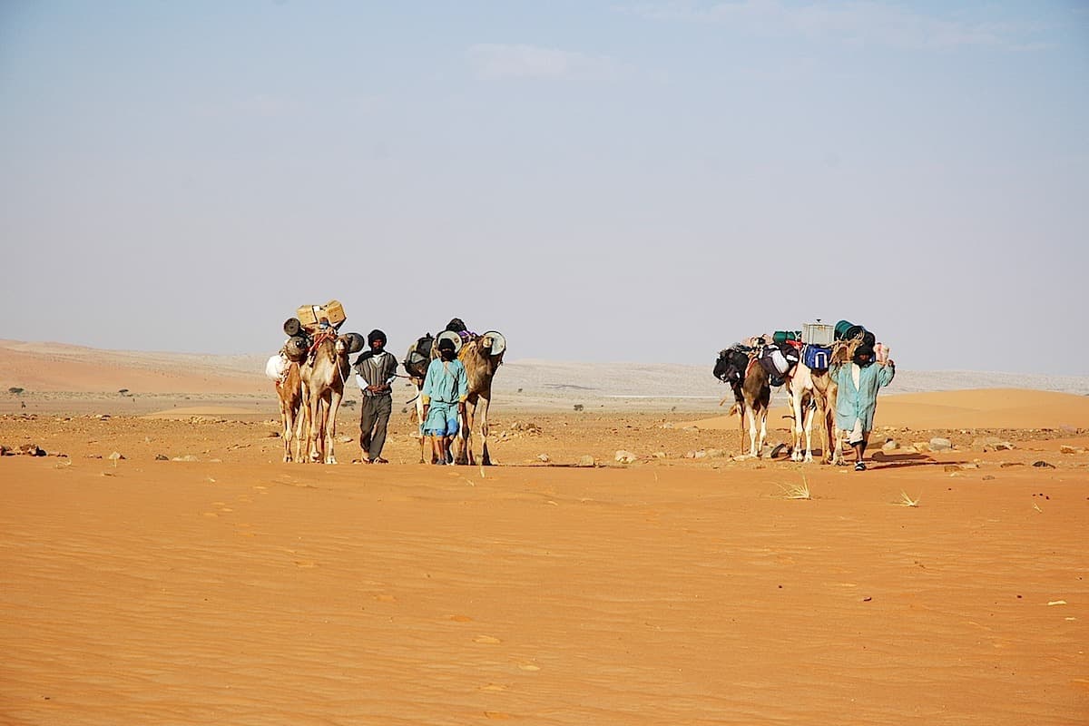
Through the sands of Maghteir towards Cape Tazazmout
Erg Maghteïr 2 → Touizizmint
The cliff we had left behind is drawing closer again. The cape of Tazazmout emerges from the sandy ridges. The dunes advance toward the cliff of the Adrâr without ever touching it. In this natural corridor created between the sand and the rock, the oued El Beyyed flows in the direction of the west. The acacias are magnificent, protected from deforestation by their distance from urban centers. We are on the edge of Amgârîj territory. Tomorrow, crossing the cape, we will enter the domain of the Ahel Cheikh Mohamed Fâdel. This sheikh was the keeper of the Tarika Fadeliyya, a branch of a Sunni religious brotherhood of the Quadriyya, which was very important in eastern Mauritania. This figure was eminently influential from northern Mauritania to southern Morocco. By allegiance to this man, the tribes of the Adrâr mark the necks of their camels with the symbol "T", except for the R'gueïbat faction which bears as a distinctive sign the famous and formidable Arabic letter "qaf". We camp near the well of Touizizmint.
Through the sands of the Maghteir towards Cape Tazazmout
Touizizmint → Tarf Tazazmout
We bypass the tarf Tazazmout. Countless Neolithic and contemporary funeral sites stretch across the banks of the wadi. The great wells of Tazazmout were no longer maintained during our last passage in April 99. Now, the cliff moves away again, the aklé becomes denser and the pure lines of the dunes guide us. To the south, parallel to our direction of travel, an interdune furrow is dotted with magnificent Acacia radiana. We bivouac, immersed in the sands.
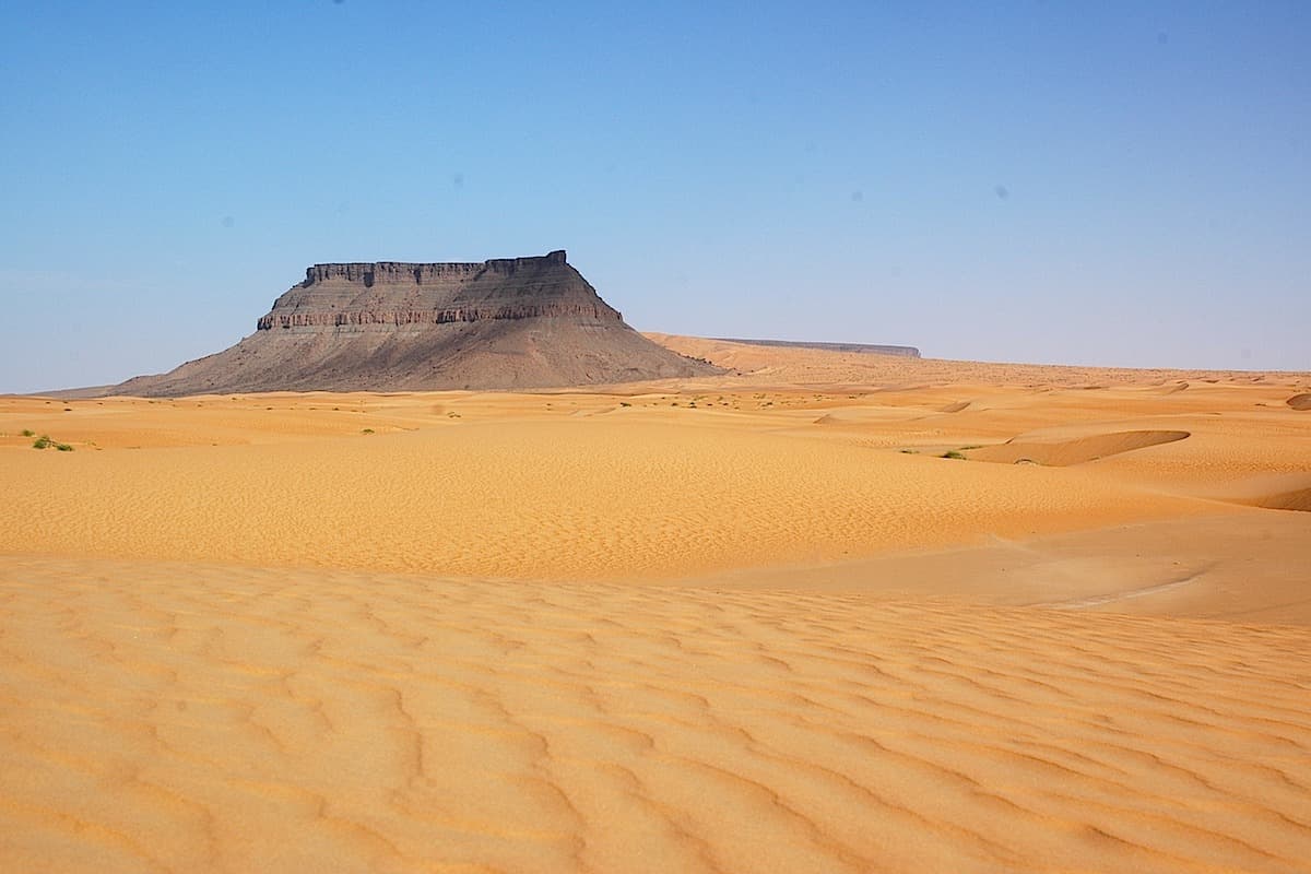
The Aderg inselberg, the white dunes of Oum El Beidh
Tarf Tazazmout → Oum El Beidh
In the distance, the Aderg massif rises like a ship's prow. As you approach the relief, the dunes become difficult for the caravan. The camel guide, far ahead, traces the path through this inextricable maze.
The Aderg inselberg rises to 650 m. and dominates the erg. Mauritanian nomads know this place well, where on the summit platform grows a plant rich in mineral salts, Askâf (Nucularia perrini), which animals and men need to survive.
In clear weather, from the top of Aderg, the panorama is magnificent. From southwest to southeast stretch the great sebkha of Chemcham and then the high cliffs of the Adrâr, with to the south, the wide fault of Akhmakou. Then, across the rest of the panorama, the waves of the Maghteïr erg undulate as far as the eye can see. Downwind, a vast dune-free zone is exposed, marked by small ribbons of trees where passing nomads huddle. A few wells are found to be slightly brackish. At the foot of the inselberg, the clear sand of Oum el Beidh (280 m.) welcomes us for the night.
Wide or narrow valleys carved into the mass of the sandstone plateau alternate with rocky coasts and plateaus sometimes invaded by sand.
Pastures, often wooded, alternate with dunes, which vegetation takes over when rainfall has been sufficient.
Sahelian and Saharan flora is particularly abundant: mrokba (Panicum turgidum), sbot (Aristida pungens), girgir (Schouwia purpurea), el gasba (Tragus racemosus), a grass whose spikelets are armed with hooked spines, tadaresa (Tribulus), tamachal, akchit, talebat, tigingilit (a plant with small red flowers), colocynths, as well as another grass, initi or cram-cram (Cenchrus biflorus) whose seeds cling persistently to shoelaces, trouser legs and socks!
Trees are numerous, particularly in the valleys: teichot (Balanites aegyptiaca) with powerful thorns, atil (Maerua crassifolia), ifernan (Euphorbia balsamifera) or Tree of Hell, with abundant sap, sder (Ziziphus lotus and mauritania, jujubes), turjit (Calotropis procera) or Apple of Sodom, not to mention various acacias including talha and tamat. One shrub has particularly fragrant flowers, Boscia senegalensis.
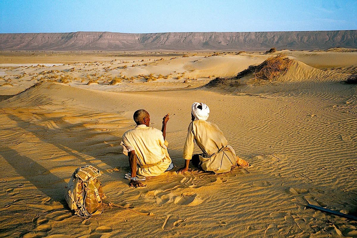
The well of Naïtiri
Oum El Beidh → Hassi Naïtiri
After crossing the small aklé of Oum el Beïdh, we now travel on a slight reg towards the alluvial basin of Naïtiri. We reach the well of Naïtiri,
The area is very wooded, with sometimes dense vegetation developing there. A few greïr are cultivated by sedentary people living in a few tents visible here and there, and very often, many herds roam the region. The camel drivers take advantage of their passage to the Naïtiri wells to water their animals.
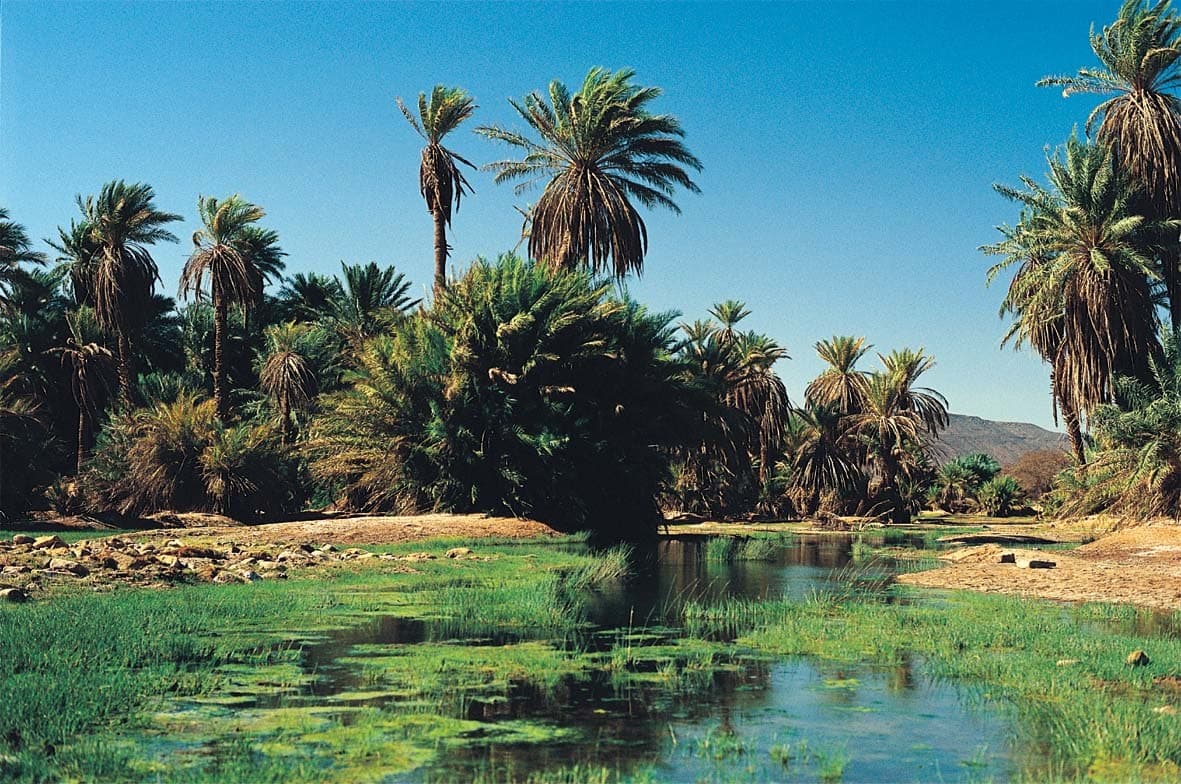
Full south in the Akhmakou fault
Hassi Naïtiri → Hassi Akhmakou
Due south, we reach the foothills of Tarf Naïtiri and, gradually, we enter the Akhmakou fault.
This fault, as well as that of the Ivernouane wadi that we will discover in the coming days, are part of the geomorphological complex of Richât. They are parallel to the edge of Tagenzé. The landscape changes and sand gradually gives way to rock, at the bottom of a wadi. We bivouac near Hassi Akhmakou.
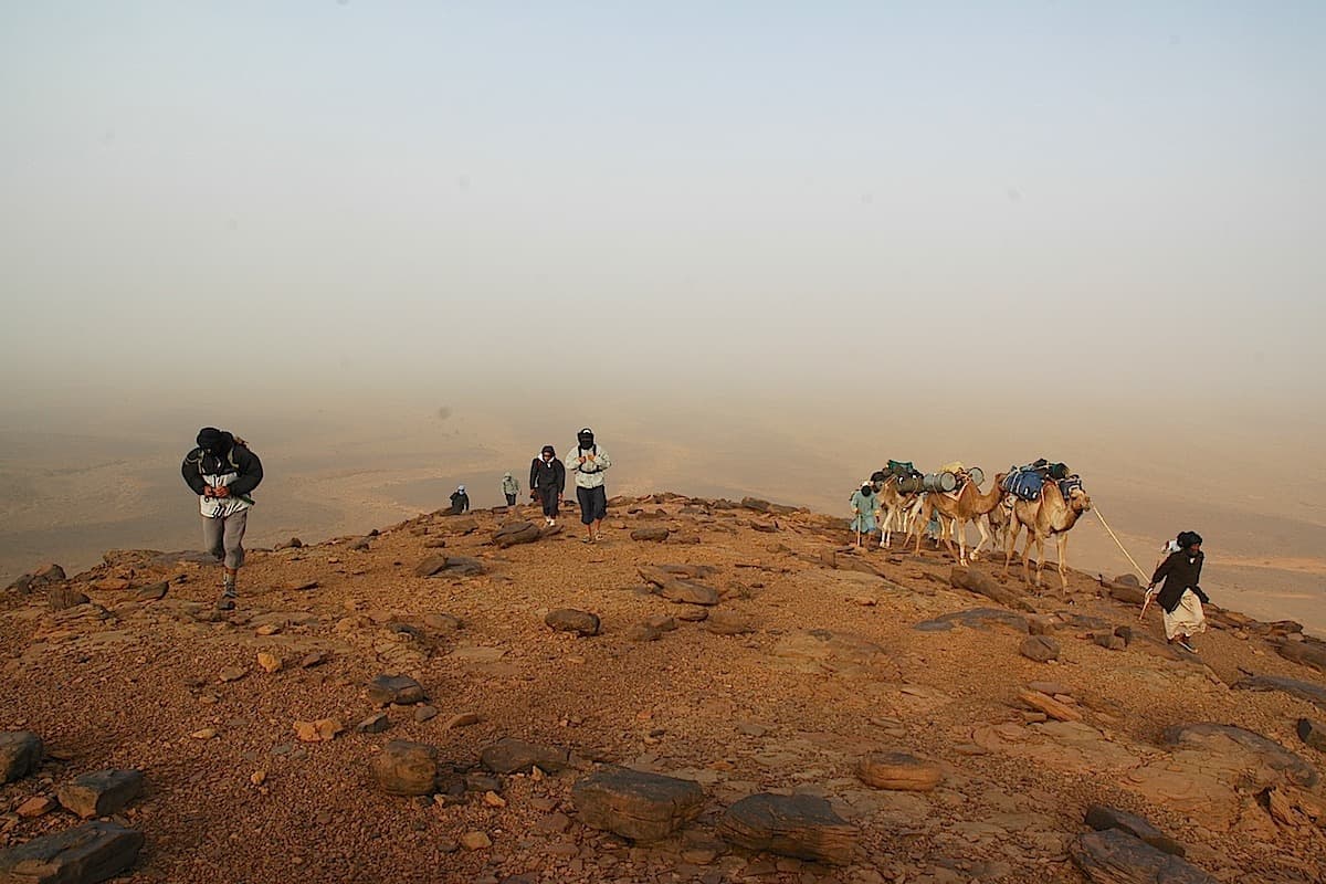
Progression through a long gorge then the Adrar plateau
Hassi Akhmakou → Passe Akhmakou
The gorge forces the caravan to proceed slowly.
From time to time, we cross small palm groves that appear abandoned. The nomads, who own the plants, only come to pollinate them if they are located within a nearby perimeter.
At the end of the day, we reach the Adrâr plateau by a steep camel track. A few patches of sand welcome us for the night.
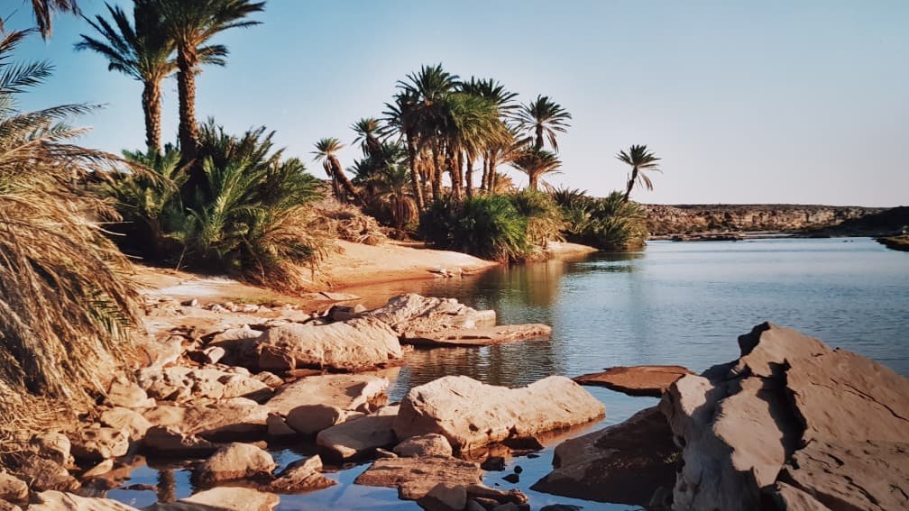
By passing through the geological formation of Semssiyyât, the secret gorges
Passe Akhmakou → Semssiyyât
A full day of walking is necessary. The austere regs of the Adrar are present once again. A small geological formation similar to Guelb er Rîchât can be found halfway through the stage.
The place is called Semssiyyât, the Sunny Places.
Semssiyyât → Timagrat Ivenouane
We continue our hike to reach, in the evening, the edge of the <oued Ivernouane. This oued cuts deeply into the plateau.
It took 6 years of strong relationships with the Amgârîj nomads for them to allow us to discover this fissure that is very important for their valley and their life.
The hydrographic basin of this immense oued drains all the waters from the bare plateaus.
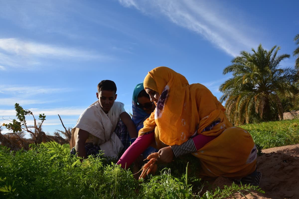
Gueltas, rock art of the Ivenouane gorge
Timagrat Ivenouane → Foum el Mouïne
The gueltas of Fôum n-Moueï are immense and dot the gorge like a string of beads. Here and there, a few clusters of palm trees and some Tikkits blend discreetly with the surrounding rock.
Descending into the wadi bed proves difficult and camel herders usually stay on the plateau. There are a few rare rock painting sites to discover.
Foum el Mouïne → Amont Tin Labbe
The wadi widens and we emerge at the bottom of the Tin Labbé valley. We stop for the night before reaching the first dwellings.
Not far from us remain the ruins of déshrât bavour, the city of the bafours, and they show the tomb of Bafour himself, personified and compared to a sovereign, or a tyrant, non-Muslim…
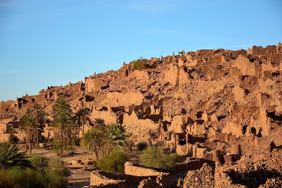
Gentle arrival in the Tin Labbé valley then Wadâne
Amont Tin Labbe → Tin Labbé
At Tin Labbé, we are in the stronghold of camel herders with whom we share these days.
According to history, the Amgârîj tribe and the Tin Labbé valley have been linked since very ancient times.
This dates back to the time of the Almoravides – 1050 AD – Abu Bakr, after continuing the conquests begun by his predecessors, is said to have returned to the Sahara.
Having stayed in the Djebel Lemtouna (the Adrâr), he is said to have left the palm grove of Tin Labbé calling the inhabitants magrij. This term designates the pollination of palm trees and from there comes the name of the inhabitants of the palm groves of Tin Labbé: Amgârîj.
The word may be of Berber origin but it is in any case not Arabic.
The Tin Labbé palm grove does not require irrigation. It is enough to pollinate the palm trees. The Amgârîj are camel herders and are content to return to this valley for the date harvest, the guetna.
The crops are important. Water surfaces in a few places and allows vegetation that can be lush.
Tin Labbé → Wadane
The Tin Labbé valley flows towards Wadane which we reach quickly through the palm grove. We now arrive at the foot of the ruins of the ramparts that protected the city.
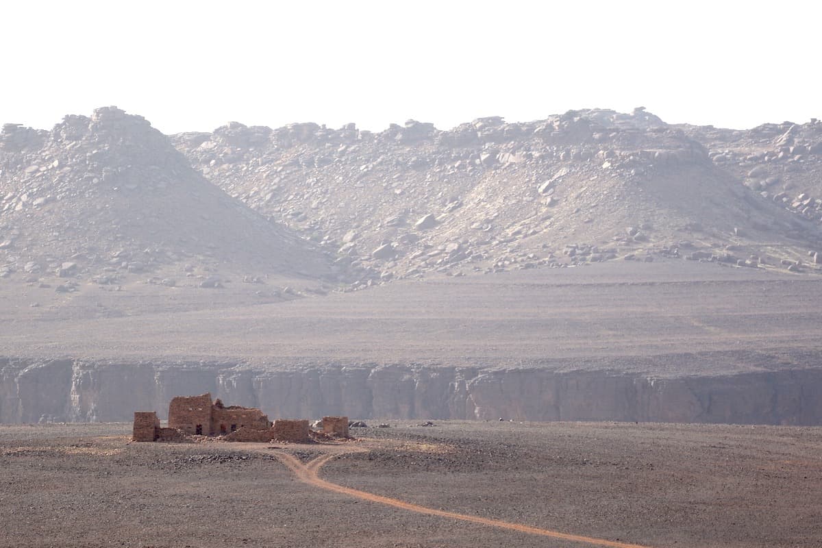
By track, return to the capital of the Adrâr
Due west, the good track takes us to Atar. It runs along the northern edge of the major Adrar cliff. We will leave the Amogjar pass and the remains of Fort Saganne to descend into the Atar basin.
The city of Atar founded in the 17th century in the borderland plain (bâten) that stretches north of the great cliff, is preserved from sand by its geographical location.
It is the most important city in the Saharan zone. It was formerly an emirate city a garrison town for the Americans then the French and finally a regional capital.
Return to Nouakchott
We head west. We leave the last plateaus of the Adrâr to reach the Yagref basin.
The cones of black rocks, the dune ridges of the Amatlich mark the landscapes of the Amsaga.
Then, the vast plains of the Inchiri take us to the Atlantic coast and the capital of Mauritanie.
Nouakchott → Paris Aéroport
Following your flight schedule to France, we transfer you to the Nouakchott-Oumtounsy International Airport.
Practical Information
Registration is considered firm and final after payment of a deposit of 30% of the total price and acceptance of the specific terms of sale.
The balance must be paid no later than 45 days before the departure date.
See our specific terms of sale for full details.
In the event of cancellation by the traveller, the following fees apply:
- Plus de 60 jours avant le départ : 40 % du prix total (acompte retenu)
- Entre 60 et 30 jours avant le départ : 50 % du prix total
- Moins de 30 jours avant le départ : 100 % du prix total
We strongly recommend taking out cancellation insurance. See our specific terms of sale for full details.
Les informations ci-dessous concernent les voyageurs ressortissants de l'Espace économique européen (EEE), de la Suisse et du Canada se rendant en Mauritanie dans le cadre d'un séjour touristique. Les règles d'entrée pouvant évoluer, nous vous recommandons de vérifier les informations auprès des autorités officielles avant votre départ.
Passeport
Pour entrer en Mauritanie, votre passeport doit être valide au minimum six mois après la date d'entrée dans le pays et comporter au moins une page vierge pour les tampons d'immigration.
Le document doit être en bon état (pas de pages détériorées, déchirées ou modifiées).
Visa
Les ressortissants de l'Espace économique européen, de la Suisse et du Canada doivent en principe être munis d'un visa pour entrer en Mauritanie. Ce visa peut être obtenu :
auprès de l'ambassade ou du consulat de Mauritanie dans le pays de résidence avant le départ,
ou, selon les conditions en vigueur, à l'arrivée à l'aéroport international de Nouakchott (visa on arrival), pour un séjour pouvant aller jusqu'à 30 jours.
Il est fortement recommandé de se renseigner auprès des autorités mauritaniennes ou de l'ambassade compétente avant le départ, les modalités d'obtention du visa pouvant évoluer.
Les autorités peuvent demander :
un billet de sortie du territoire (vol retour ou continuation),
une preuve de ressources financières suffisantes pour la durée du séjour,
une réservation d'hébergement ou une lettre d'invitation.
Santé et vaccinations
Aucune vaccination n'est officiellement obligatoire pour entrer en Mauritanie, à l'exception du vaccin contre la fièvre jaune si vous arrivez en provenance d'un pays où cette maladie est endémique.
Cependant, plusieurs vaccinations sont fortement recommandées par les autorités sanitaires :
Hépatites A et B
Typhoïde
Méningite à méningocoque
Rage (selon les activités prévues)
Mise à jour du calendrier vaccinal habituel (diphtérie, tétanos, poliomyélite)
La prophylaxie antipaludéenne est recommandée pour l'ensemble du territoire mauritanien. Consultez un médecin ou un centre de vaccinations internationales avant votre départ.
Sécurité et enregistrement
Les autorités mauritaniennes peuvent exiger l'enregistrement des voyageurs étrangers auprès des services de police ou de la gendarmerie locale dans les 48 heures suivant l'arrivée, notamment en dehors de la capitale. Il est conseillé de se renseigner sur les obligations en vigueur au moment du voyage.
En raison du contexte sécuritaire dans certaines régions du pays, il est recommandé de consulter les conseils aux voyageurs délivrés par les autorités de votre pays de résidence avant le départ.
Voyage avec des enfants
Les mineurs doivent être titulaires de leur propre passeport valide couvrant la durée du séjour.
Dans certains pays européens, lorsqu'un mineur voyage sans l'un de ses parents, une autorisation de sortie du territoire peut être exigée selon la réglementation du pays de résidence.
Autres nationalités
Les conditions d'entrée peuvent varier selon la nationalité. Les voyageurs concernés doivent se renseigner auprès de l'ambassade ou du consulat de Mauritanie de leur pays de résidence.
Pour participer à nos voyages, il est fortement conseillé d'être assuré en assistance-rapatriement et frais médicaux à l’étranger.
Votre agence locale vous encourage à prendre connaissance du contrat spécifique élaboré avec notre partenaire CHAPKA ASSURANCES et AXA ASSISTANCE.
Pour souscrire à une assurance, connaître les garanties et les tarifs, suivez le lien ci-dessous.
CAP EXPLORER : La solution d’assurance complète conçue pour vivre sereinement votre voyage !
Choisissez la formule qui vous correspond le mieux:
Explorer'Multirisque
Explorer'Annulation
Explorer'Assistance
Explorer' Complémentaire Carte Bancaire
Spécifiques à nos voyages, nous suggérons fortement d’y souscrire.
Si vous choisissez de souscrire à l’une de ces formules, la convention détaillant l’ensemble des garanties et les modalités de déclaration du sinistre sont disponibles sur le site Internet de l'assureur.
Votre agence locale en aura connaissance, mais seul le participant est responsable du respect des procédures de déclaration de tout sinistre. Le participant doit donc conserver cette convention avec lui pendant toute la durée de son voyage.
Chapka — Cap Explorer
Our insurance partnerTravel with peace of mind with our partner Chapka. Cancellation, repatriation, medical expenses, baggage… All the coverage for a worry-free trip.
Travel with peace of mind — I'll handle the insuranceFrequently asked questions
Oui, un visa touristique est obligatoire pour les ressortissants français, délivré à l'arrivée à l'aéroport de Nouakchott (55 euros pour 30 jours) ou auprès du consulat. Passeport valide au moins 6 mois après l'entrée requis. Le contexte sécuritaire impose une vigilance accrue.
Rendez-vous dans la section Mes Voyages pour retrouver tous vos projets.
Vous pouvez envoyer un message à votre hôte directement depuis le Salon de Thé.
Pour un voyage sur mesure de qualité, comptez entre 180 et 300 euros par jour et par personne, incluant hébergement, repas,4x4 avec chauffeur et guide francophone. Les vols internationaux (500-800 euros A/R) sont en supplément. Le désert, le train du Sahara et les plages représentent des expériences uniques.
Vos documents sont accessibles dans l'onglet Documents de votre voyage.
Absolument. Nous adaptons chaque circuit au profil des voyageurs. Pour les familles, nous privilégions des rythmes détendus, des hébergements familiaux, des activités ludiques et pédagogiques, et des transferts privés confortables. Nos guides locaux francophones savent capter l'attention des enfants avec des anecdotes adaptées à leur âge.
C'est simple. Vous échangez avec notre équipe locale pour définir vos envies, votre budget et vos dates. Vous recevez une proposition d'itinéraire détaillée sous 48 heures. Vous ajustez ensemble chaque détail jusqu'à la version parfaite. Vous confirmez et partez l'esprit tranquille. Votre agence locale reste disponible 7j/7 pendant toute la durée du voyage.
En cas d'urgence, contactez immédiatement votre agence locale.
Le paiement s'effectue généralement en deux fois.
Notre agence fait partie du réseau Nomadays, immatriculé en France. Vous bénéficiez de la garantie APST (Association Professionnelle de Solidarité du Tourisme) qui couvre 100% de vos fonds. Paiement sécurisé, assurance rapatriement incluse, et assistance francophone 24h/24 sur place pendant tout votre séjour.
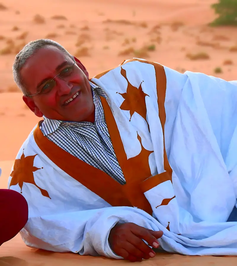
Let's talk about your adventure — Adrar
Craftsperson of journeys in the heart of Mauritania, based in Atar
Mauritania is a country that reveals itself with respect and patience. My role is to help each traveler approach it in the best conditions, with confidence and curiosity.
— Isselmou